Quantification of carbon stocks may be carried out using Approved Tier 1 or 2 Maps, or Tier 3 Inventory methods combined with remote sensing, where Tier 1 or 2 are unavailable.
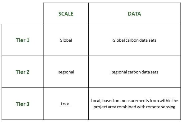
Characteristics of Tiers of data sources
Tier 3 Inventory Methods
The carbon stock values adopted should provide a conservative estimate of carbon stocks at the start of the project. The maps should therefore be recent, and have a known error. Carbon stock maps can be derived from a combination of remote sensing data and ground-based survey or default values of carbon stocks.
The validity of the carbon stock map will be assessed by the NFS Technical Committee, who will consider an appropriate, conservative factor to apply on the level of uncertainty.
Baseline Assessment
To be approved, methods should provide a credible, conservative, baseline scenario of emissions from deforestation and/or degradation in the absence of the project activities. The Standard recommends risk-based approaches to provide baseline emissions scenarios, such as the ACEU method described in Grace et al 2010.
Outputs of Risk Assessment
The outputs of both Tier 2 and Tier 3 Risk Assessments should be a map of the project area and leakage zones, with areas categorised into the following classes:
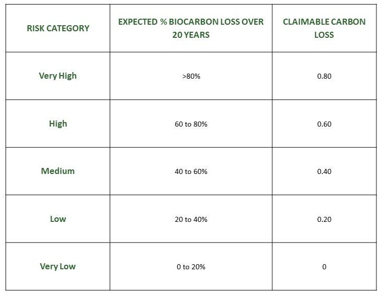
Risk Category Model