What’s The Point? (of points, when carbon projects cover areas)
Land based carbon projects now make up the majority of carbon credit transactions. Each project takes place on a landscape that is increasingly contested for the production of goods, biodiversity, living space and other uses. Yet the registries of the major carb programs represent these projects as points on a map, regardless of their size, making it difficult to understand the precise geographic co-ordinates.
Point maps are almost pointless when it comes to understanding potential overlaps and conflicting claims. They certainly don’t live up to the transparency demands of ICVCM Core Principle 2.
So, Let’s Get Into Shape(s)
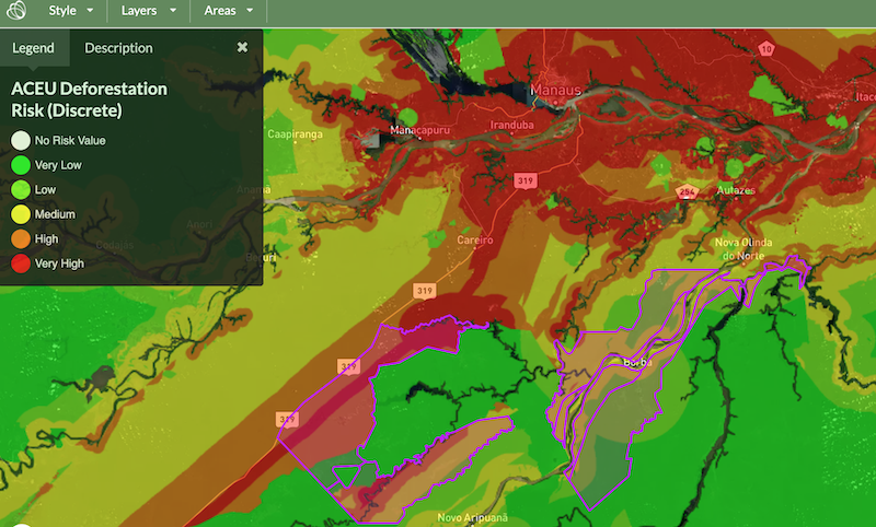
Thats why the NFS has introduced the Map Registry to ensure that every project area generating credits under the Standard is clearly represented by an accurately geo-referenced polygon.
These project area polygons can be used like cookie cutters to extract key data such as forest risk levels and carbon stocks.
We invite you to take a look via this link to the registry.